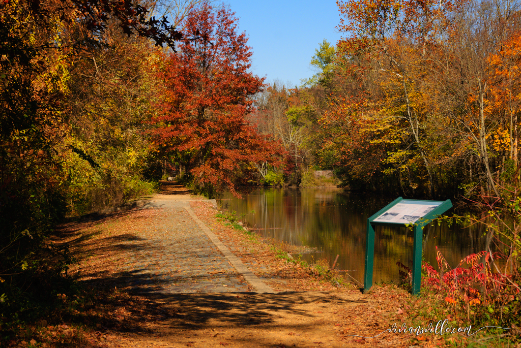
The towpaths of the D&R Canal State Park are among Central New Jersey's most unspoiled and historic attractions.
What we see today – the canal, towpaths and related structures – was built around the 1830s as a shipping lane for cargo, mainly coal, from the ports of Philadelphia to New York. Built mostly by hand, the Delaware & Raritan Canal was an ingenious route employing a system of locks to raise and lower water levels, and swing bridges to provide clearance for boats and barges to pass. A busy waterway in service for nearly one hundred years, canal operations closed by the 1930s as railroads made transport faster and more reliable. The canal, however, remained an important water supply system, a function it still serves today. In the 1970s the D&R Canal was designated an official State Park and preservation of this once vital part of New Jersey’s industrial history was ensured. The towpaths where teams of mules once pulled barges and boats now serve as a recreational byway enjoyed by walkers, runners, cyclists, fisherman, cross-country skiers and horseback riders. Under the protection of the D&R Canal Commission which guards approximately seventy miles that make up the park from development or encroachment, and with regular maintenance of its paths and parking lots, it’s easy to see why this is such a pleasant escape.
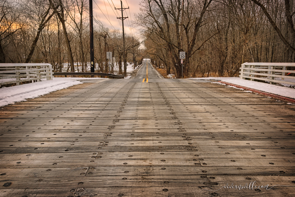
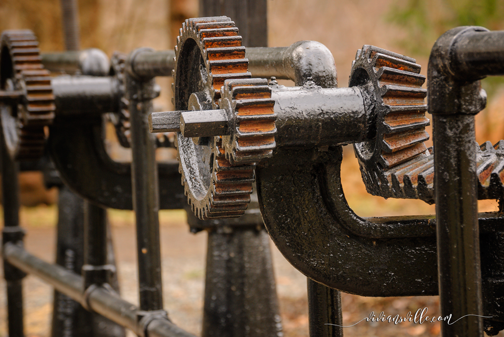
Blackwells Mills Road and Weston Canal Road, as well as Colonial Park's pedestrian bridge, are the closest access points to the park near the Blackwells Mills Canal House. Built in 2009, the pedestrian bridge connects Colonial park to the towpath, greatly expanding recreational opportunities at both. There’s something so relaxing and peaceful about a towpath walk that it’s easy to lose track of time and distance. Each segment of the park has its own distinct character and features which make exploring each one a wonderful experience. Like the Blackwells Mills Canal House, some old bridgetender homes remain as museums which open to the public periodically for special events. Other sections feature the sculptural black forms of the old lock mechanisms with their large interlocking gear wheels. The swing bridges are long gone replaced by causeways in Blackwells Mills and Griggstown but it’s easy to imagine how they functioned in their heyday.
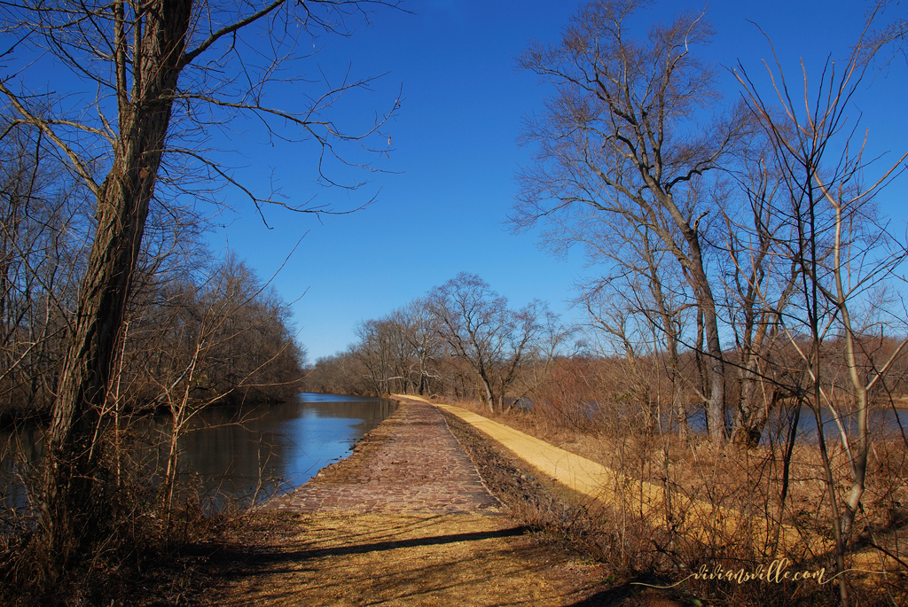
The biggest attraction in this linear park is the enjoyment of nature as you travel along trails tucked away from busy roads, cooled by the shade of the trees or warmed by bright, sunny patches at clearings. A feature common to many of the park’s segments is a rocky but passable spillway, simple one-foot depressions in the towpath one hundred feet or more in length, clad with stone to prevent erosion. These are typically dry and and perform the important function of channeling excess storm water away from the canal and the paths into adjacent streams or rivers. At some spots in the park there are interpretive signs explaining history and other facts. Some concrete mile markers still remain – one side showing the distance to the southern terminus in Burlington and the other to the northern terminus in New Brunswick. Always present is the unobstructed view of the canal placidly flowing by on one side of the path and of natural areas on the other. Every season puts its special touches here whether in fragrant spring blooms, lush summer greens or fiery autumn foliage. Waterfowl love the canal and so do muskrats.You might glimpse a heron fishing or turtles basking in the sun, perched by the dozen on logs. Besides recreation on dry land, there’s canoeing and kayaking on the water and also fishing. But that is a story for another time!
© 2013, Vivian S. Bedoya
What we see today – the canal, towpaths and related structures – was built around the 1830s as a shipping lane for cargo, mainly coal, from the ports of Philadelphia to New York. Built mostly by hand, the Delaware & Raritan Canal was an ingenious route employing a system of locks to raise and lower water levels, and swing bridges to provide clearance for boats and barges to pass. A busy waterway in service for nearly one hundred years, canal operations closed by the 1930s as railroads made transport faster and more reliable. The canal, however, remained an important water supply system, a function it still serves today. In the 1970s the D&R Canal was designated an official State Park and preservation of this once vital part of New Jersey’s industrial history was ensured. The towpaths where teams of mules once pulled barges and boats now serve as a recreational byway enjoyed by walkers, runners, cyclists, fisherman, cross-country skiers and horseback riders. Under the protection of the D&R Canal Commission which guards approximately seventy miles that make up the park from development or encroachment, and with regular maintenance of its paths and parking lots, it’s easy to see why this is such a pleasant escape.
Blackwells Mills Road and Weston Canal Road, as well as Colonial Park's pedestrian bridge, are the closest access points to the park near the Blackwells Mills Canal House. Built in 2009, the pedestrian bridge connects Colonial park to the towpath, greatly expanding recreational opportunities at both. There’s something so relaxing and peaceful about a towpath walk that it’s easy to lose track of time and distance. Each segment of the park has its own distinct character and features which make exploring each one a wonderful experience. Like the Blackwells Mills Canal House, some old bridgetender homes remain as museums which open to the public periodically for special events. Other sections feature the sculptural black forms of the old lock mechanisms with their large interlocking gear wheels. The swing bridges are long gone replaced by causeways in Blackwells Mills and Griggstown but it’s easy to imagine how they functioned in their heyday.
The biggest attraction in this linear park is the enjoyment of nature as you travel along trails tucked away from busy roads, cooled by the shade of the trees or warmed by bright, sunny patches at clearings. A feature common to many of the park’s segments is a rocky but passable spillway, simple one-foot depressions in the towpath one hundred feet or more in length, clad with stone to prevent erosion. These are typically dry and and perform the important function of channeling excess storm water away from the canal and the paths into adjacent streams or rivers. At some spots in the park there are interpretive signs explaining history and other facts. Some concrete mile markers still remain – one side showing the distance to the southern terminus in Burlington and the other to the northern terminus in New Brunswick. Always present is the unobstructed view of the canal placidly flowing by on one side of the path and of natural areas on the other. Every season puts its special touches here whether in fragrant spring blooms, lush summer greens or fiery autumn foliage. Waterfowl love the canal and so do muskrats.You might glimpse a heron fishing or turtles basking in the sun, perched by the dozen on logs. Besides recreation on dry land, there’s canoeing and kayaking on the water and also fishing. But that is a story for another time!
© 2013, Vivian S. Bedoya
 RSS Feed
